


Voting District G2, Cumberland County, North Carolina
About
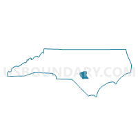
Outline

Summary
| Unique Area Identifier | 639819 |
| Name | Voting District G2 |
| County | Cumberland County |
| State | North Carolina |
| Area (square miles) | 33.37 |
| Land Area (square miles) | 32.94 |
| Water Area (square miles) | 0.44 |
| % of Land Area | 98.69 |
| % of Water Area | 1.31 |
| Latitude of the Internal Point | 35.15983790 |
| Longtitude of the Internal Point | -78.88372390 |
Maps


Graphs
Select a template below for downloading or customizing gragh for Voting District G2, Cumberland County, North Carolina


Neighbors
Neighoring Voting District (by Name) Neighboring Voting District on the Map
- Voting District CC05, Cumberland County, NC
- Voting District CC16, Cumberland County, NC
- Voting District CC17, Cumberland County, NC
- Voting District EO61-1, Cumberland County, NC
- Voting District G11, Cumberland County, NC
- Voting District G7, Cumberland County, NC
- Voting District LI65, Cumberland County, NC
- Voting District PR01, Harnett County, NC
Top 10 Neighboring County Subdivision (by Population) Neighboring County Subdivision on the Map
- Cross Creek township, Cumberland County, NC (66,163)
- Manchester township, Cumberland County, NC (24,643)
- Carvers Creek township, Cumberland County, NC (22,866)
- Anderson Creek township, Harnett County, NC (14,060)
- Eastover township, Cumberland County, NC (12,753)
Top 10 Neighboring Place (by Population) Neighboring Place on the Map
Top 10 Neighboring Unified School District (by Population) Neighboring Unified School District on the Map
- Cumberland County Schools, NC (297,793)
- Harnett County Schools, NC (114,678)
- Fort Bragg Schools, NC (21,638)
Top 10 Neighboring State Legislative District Lower Chamber (by Population) Neighboring State Legislative District Lower Chamber on the Map
- State House District 45, NC (83,066)
- State House District 53, NC (80,426)
- State House District 42, NC (68,445)
- State House District 43, NC (50,825)
Top 10 Neighboring State Legislative District Upper Chamber (by Population) Neighboring State Legislative District Upper Chamber on the Map
- State Senate District 22, NC (202,925)
- State Senate District 19, NC (190,504)
- State Senate District 21, NC (164,117)
Top 10 Neighboring 111th Congressional District (by Population) Neighboring 111th Congressional District on the Map
Top 10 Neighboring Census Tract (by Population) Neighboring Census Tract on the Map
- Census Tract 37, Cumberland County, NC (7,322)
- Census Tract 25.01, Cumberland County, NC (7,267)
- Census Tract 25.02, Cumberland County, NC (7,080)
- Census Tract 25.04, Cumberland County, NC (6,127)
- Census Tract 12, Cumberland County, NC (5,617)
- Census Tract 25.03, Cumberland County, NC (5,262)
- Census Tract 706, Harnett County, NC (4,377)
- Census Tract 11, Cumberland County, NC (4,251)
- Census Tract 26, Cumberland County, NC (4,218)
- Census Tract 24.02, Cumberland County, NC (3,379)
Top 10 Neighboring 5-Digit ZIP Code Tabulation Area (by Population) Neighboring 5-Digit ZIP Code Tabulation Area on the Map
- 28311, NC (34,567)
- 28390, NC (19,942)
- 28312, NC (18,538)
- 28301, NC (17,165)
- 28356, NC (5,018)
- 28395, NC (2,375)